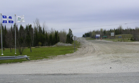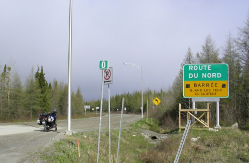
RouteduNord
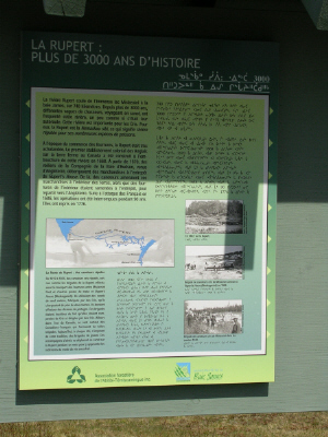
The Route du Nord (North Road) is a modern gravel roadway running 407 kilometers (253 miles) from Route 167 just east of Chibougamau to Route de la Baie James (James Bay Road) at kilometer 275 (171 miles) from its start in Matagami. Both roads cross the Rivière Rupert (Rupert River), soon to have its headwaters diverted into Hydro-Quebec's La Grande hydroelectric complex to the north, resulting in reduced flow at these two scenic road crossings downstream from the diversion point. A good guide to both roads and the James Bay area generally is available at the James Bay Road website.
The diversion will augment Hydro-Quebec's capacity to deliver power to the New England states and New York, but with significant environmental consequences. More information about the diversion, including maps and simulations, is available online at: Wikipedia, Rupert River; Wikipedia, James Bay Project (esp. Rupert River diversion); Ministère du Développement durable, de l’Environnement et des Parcs, Eastmain 1-A and Rupert River Diversion Hydropower Project; Hydro-Quebec, Eastmain-1-A/Sarcelle/Rupert Project; and B. Mann, Hydro-Electric Project To Reshape Wilderness, NPR (July 14, 2008).
But this article is about motorcycling, not politics. As indicated at the conclusion of Wee-Strom in Labrador, the North Road presents an inviting challenge for the dual sport motorcycle enthusiast. Early June provides as good a time as any to run it, maybe even a chance to beat the black flies, while the impending diversion of the Rupert counsels against further postponement. So, although the idea had been germinating for quite awhile, the decision to go was made only a couple days before departure.
The vehicle for the trip was the same reliable 2005 Suzuki V-Strom DL 650 (Wee-Strom) that had taken me to Dawson City and Alaska in 2005 and across Labrador in 2007. Since that trip, the bike had acquired three new farkles of note: Garmin Zumo 550 GPS, Sargent seat, and GI Pro gear indicator, not to mention a slightly louder Scorpion muffler.
The GPS, useful for monitoring speed on paved highways as well as for directions, was removed for the North Road portion. The Sargent seat proved its worth on the two Montreal-Chibougamau legs of the trip, roughly 450 miles each way ridden in around eight hours. The gear indicator was particularly helpful on the North Road. With six speeds and frequent use of both fourth and fifth for extended distances, a quick reminder of the gear in use facilitated avoidance of some unnecessary shifts.
A new Michelin Anakee rear tire and a new chain were fitted at the last moment, not enough time to obtain a new rear sprocket for replacement with the chain, but fortunately the old sprocket still appeared in pretty decent shape. Since no fuel is available between Nemaska and Matagami, a distance of over 250 miles, the extra fuel tank was reinstalled. It adds almost two gallons to the 5.8 of the standard tank, which by itself allows a range of approximately 250 miles, not quite sufficient to undertake the Nemaska to Matagami leg with an adequate margin of reserve.
In theory at least, the rider's abilities should have been improved by reason of taking BMW's off-road motorcycle training course last spring, an excellent program that I unreservedly recommend. Among the various drills were several relating to hard braking on dirt or gravel roads, including a lesson on the dangers and ineffectiveness of ABS brakes on these surfaces where the key to quick stopping is a skidding tire that builds a ridge of dirt and gravel in front of it.
For the course use of BMW bikes (rental or your own) was mandatory, and all were equipped with ABS brakes and a switch to disable the ABS feature when appropriate. ABS brakes were not available on 2005 V-Stroms like mine. More recent models offer ABS as an option, but without a disabling switch. Automotive ABS systems are typically always on, making them far less effective on gravel (or loose snow) than many drivers expect.
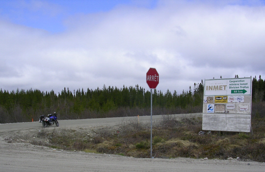
Leaving Chibougamau on Monday, June 8, at around 8:00 a.m., the temperature was below 5°C (41°F) -- brisk for riding at speed -- with intermittent rain. On the North Road, the rain kept the dust down but made the smoother sections a bit slick. Thankfully, it was insufficient to produce mud. The roadway appeared a bit wider than the Trans-Lab but with not quite as much deep loose gravel. The skies had begun to clear by the time I made my first stop, at the access road to the Trolius Gold Mine (below).
From there until I reached the Rupert River at Km 238 of the North Road, the skies continued to brighten, resulting in perfect weather for taking photographs. What is more, there were no black flies or mosquitoes. My bottle of DEET bought for the Labrador trip remains unopened, and the Allagash hat picked up from L.L. Bean for this adventure was donned only to shed rain.
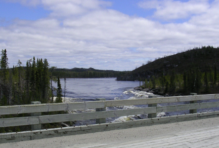
Bridge over the Rupert.
Looking upstream (east) from the bridge.
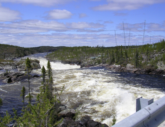 Downstream from the bridge.
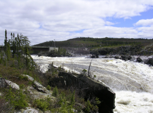
Entry to viewing area southwest of the bridge (left), and looking from the viewing area upstream toward the bridge (below).
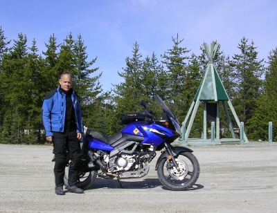
The author's trusty V-Strom.
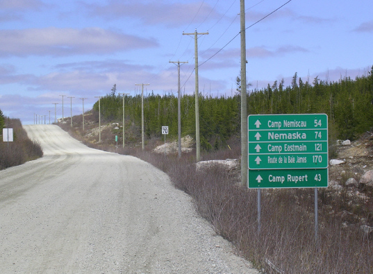
Back on the road. Note the speed limit. From the Rupert, I headed to Nemaska for lodging and to refuel for the trip to Matagami the next day. However, at certain hours fuel is also available at Km 291, eight kilometers before the access road to Nemaska, at the Relais Routier operated by the Cree Construction Co. Since their pumps were open, I refueled there, obviating any possibility of having to delay leaving Nemaska until after its fuel station opened at 9:00 a.m. the next morning, but adding about 18 kilometers to my planned longest run between fuel stops.
The Cree are predominantly English-speaking, making Nemaska and the other native communities in Baie James a welcome interlude for those not fully comfortable in French. However, the restaurant at the inn in the administration building did not offer beer or wine, presumably in furtherance of efforts to curb alcohol abuse, a persistent problem among the native peoples.
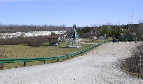
Administration building and inn, Nemaska.
Picnic area and beach, Nemaska. End of the North Road, Km 407.
Rest area at junction of North Road and James Bay Road. The North Road seemed even more remote and had less traffic than the Trans-Lab. Numerous curves and hills, although not extreme, make for plenty of obstructed views and blind rises requiring caution. As on the Trans-Lab, the posted speed limit is 70 kph (almost 45 mph), but regularly exceeded by the locals. On average, however, I found that the North Road permitted somewhat higher speeds than the Trans-Lab.
What little traffic there was consisted of a few heavy trucks, some small vans and pickups, usually carrying workers to job sites, maybe half a dozen private cars or SUV's, and no motorcycles other than me. Over the road's entire length, I encountered seven or eight graders, but they did not seem to leave as much deep gravel in their wake as those on the Trans-Lab, nor did they create a berm of soft gravel running down the middle of the road.
Apart from a very large and, to judge from its coat, apparently quite healthy Red Fox, I saw few wild animals of note. Perhaps my slightly louder than standard muffler heralded my arrival soon enough to scare some from my path. If true, it might provide some support for the otherwise dubious proposition sometimes advocated by segments of the Harley crowd: "Loud Pipes Save Lives."
With the North Road behind me, the most challenging part of the motorcycling trip was over, but perhaps the most scenic portion still lay ahead.
.JPG)
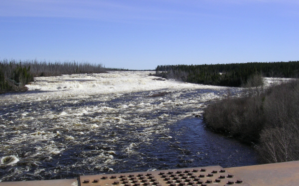
The bridge over the Rupert, Km 257 of the James Bay Road, and looking upstream (east) from the bridge to the Oatmeal (a/k/a Kaumwakweuch) Rapids.
Scenic rest and picnic area at the Oatmeal Rapids.
.JPG) The author.
The author.While stopped at the Rupert on the James Bay Road, I transferred from my reserve tank to the main tank about a gallon of gasoline, which proved just enough to get me to the fuel station in Matagami. Also, because the firm ground enabled easy use of the center stand, I took the opportunity to clean, lubricate and check the tightness of the new chain.
There is no cell phone coverage on the North Road or the James Bay Road; however, a few emergency phones are located along the latter. Carrying a satellite phone might be advisable, particularly in winter, but so far as I am aware, none are available gratis as on the Trans-Lab. Due to its remoteness, vehicles taking the James Bay Road are urged to register at its entry point. However, since the North Road has no checkpoint, vehicles entering from this direction do not have an opportunity to register.
Checkpoint at entry to James Bay Road.
R-1005 to Lebel-sur-Quévillon As I left the James Bay Road, the folks manning the checkpoint advised that R-1005, 115 kilometers of gravel road leading to Lebel-sur-Quévillon, was in good shape and roughly comparable to the North Road. However, having to go first to Matagami for fuel, I decided to continue on Route 109 to Amos, a town I had never visited, and then to cut across to pick up Route 113 in Senneterre and return on it through Lebel-sur-Quévillon and Chapais to Chibougamau. Route 113 connects Val-d'Or with Chibougamau, 225 miles away. Before its completion in 1967, anyone driving from Val-d'Or (or elsewhere in the Abitibi region) to Chibougamau had to go back through Montreal and north again, a distance of some 750 miles.
 Fuel at Junction of Routes 113 and
167.
Fuel at Junction of Routes 113 and
167.The weather was cold and wet as I prepared to head back to Montreal, 450 miles and eight hours away by the shortest route. The total round trip from Montreal including the North Road was just over 1800 miles.
Traveling the far north on a modern motorcycle is an adventure, but scarcely a test of wilderness survival skills. A trip like mine bears no comparison to those of the pre-World war II prospectors and other explorers of Canada's vast northern territories. See, e.g., A. Hoffman, Free Gold: The Story of Canadian Mining (originally published, 1947; republished by E & MJ Mining, McGraw-Hill, 1982); P.G. Downes, Sleeping Island: The Story of One Man's Travels in the Great Barren Lands of the Canadian North (Coward-McCann, 1943; republished, edited and with an introduction by R.H. Cockburn, Western Producer Prairie Books, 1998).
Rather, like motorcycling generally, my trip was more an exercise in risk management. Perhaps that explains the attraction of motorcycling for certain well-known investors, for example: the late Malcolm Forbes; "Investment Biker" Jim Rogers; Sam Zell, leader of Zell's Angels; and avid Harley-Davidson fan Dick Young.
Investors in the real world of human actions and unexpected events do not manage risk as if they lived in a virtual world governed by mathematical algorithms. Their world is not that of so many investment bankers and other financial gurus who believe that risk can be effectively managed through OTC derivatives. Indeed, giving these financial wizards motorcycle licenses and sending them out onto the mean streets of New York (or any other city) might well protect consumers of financial products at least as well as creating a new federal agency for the purpose or adding to the regulatory powers of the Federal Reserve.
Posted June 24, 2009