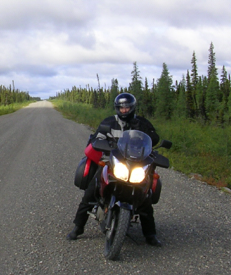
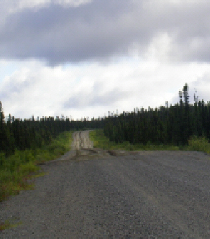
The author on the Trans-Labrador Highway
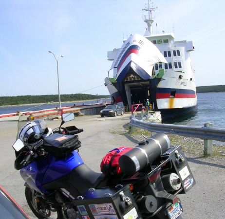
Wee-Strom in Labrador
Suzuki has given the name V-Strom to its two dual sport or adventure bikes, the DL1000 and its little brother, the DL650, sometimes referred to as the Wee-Strom. Strom, German for river, current or flow, presumably suggests go anywhere power for the DL bikes. Summer before last, my 2005 DL650 proved its mettle doing over 9000 miles in five weeks on a trip to the Yukon and Alaska, including taking the Dempster Highway as far as Eagle Plains before other commitments required my return to Dawson City.
With the global financial system threatening complete breakdown, August seemed like a good time to set aside the financial press, climb on the bike, and head into the wilderness. My trip covered 3200 miles in twelve days through Newfoundland and Labrador, including the roughly 930 highway miles from Blanc Sablon, QC, up the Labrador Coastal Drive to Cartwright, ferry to Happy Valley-Goose Bay to connect to the Trans-Labrador Highway, which runs west through Churchill Falls to Wabush and Labrador City, and then connects at the border to Quebec Route 389, which runs south from Fermont past Hydro-Quebec's mammoth Manic 5 project to Baie Comeau on the north shore of the St. Lawrence River. From Red Bay in Labrador to Manic 5 in Quebec, the road surface is gravel except for short paved stretches through the several municipalities and another 50 miles around l'ancienne ville of Gagnon, QC. See Google Map of my route; see also Quebec Hwy 389 Travel Guide.
The complete circuit presents a longer run on gravel -- approximately 675 miles -- than either the Dempster (457 miles from outside Dawson City to Inuvik on the Mackenzie Delta near the Arctic Ocean) or Alaska's Dalton Highway (414 miles from north of Fairbanks to Deadhorse on Prudhoe Bay). Of course, both the Dempster and the Dalton require retracing your path to return. Avoiding the ferry, a similar round trip to Happy Valley-Goose Bay from Baie Comeau entails approximately the same distance on gravel as the Dempster and rated the highest number of possible bonus points in the first (eastern) leg of the 2007 Iron Butt Rally. Only one competitor seems to have tried it, but crashed his Honda Gold Wing in deep gravel outside Churchill Falls. Fortunately his injuries were minor, but his bike reportedly a total loss.
On the ferry from Cartwright to Happy Valley-Goose Bay, I met an organizer of Cain's Quest (www.cainsquest.com), an endurance race for snowmobiles that takes place in March over 2000 kilometers of ungroomed trails in the Labrador wilderness. He reported seeing an increasing number of motorcycles on the Trans-Lab in the last couple of summers, perhaps due in part to interest stirred by recent articles in American motorcycle magazines. See, e.g., J. McQueen, "Labrador, Last-Chance Adventure on the Trans-Labrador Highway," Rider (June 2007). So, for fellow bikers thinking of making this trip, here are a few observations from one who has recently done so, along with some photos that may be of interest.
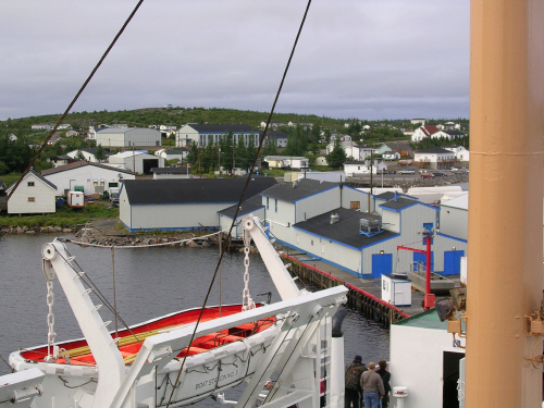
Top left: preparing to leave from St. Barbe, Newfoundland. Bottom right: arriving in Blanc Sablon, Quebec, a few miles from the Labrador border. Because motorcycles and their riders tend to attract some attention from other passengers, ferries frequently offer motorcyclists a good opportunity to meet locals or other travelers with interesting and often useful information to impart. For example, on the ferry from North Sydney to Port aux Basque, I made the acquaintance of Bill and Janine from Red Deer, Alberta, operators of a website for adventure bikers (www.backroadexplorers.ca), and riding two-up on a BMW F650 Dakar.
Planning. My decision to approach Labrador from Newfoundland rather than Quebec was dictated primarily by the rather unusual ferry schedule. From June through September, the M/V Sir Robert Bond runs twice weekly between Cartwright and Happy Valley-Goose Bay. Departures from Cartwright are at 7:00 p.m. on Saturdays and Mondays for arrival at 8:00 the following morning, and from Happy Valley-Goose Bay at 5:00 p.m. on Sundays and Tuesdays for arrival at 6:00 a.m. Truck traffic on the Trans-Lab, which is largely a haul road, tends to be less on Sundays, making it a better day for bikers. Prudence suggests leaving some extra time to make the ferry should bad weather slow the trip, and to my mind the Labrador Coastal Drive offered more enticing possibilities for using any unneeded time gifted by good weather.
In any event, reservations on this ferry should be made as early as possible. Even two weeks ahead of time, I could not get a bunk or a cabin for the overnight voyage. At the Tim Horton's in Corner Brook, NL, I met a guy from Ottawa on a Wee-Strom who was returning from Cartwright after learning that his chances of getting on the very same ferry for which I had reservations were too slim to warrant taking the chance. As it turned out, that ferry was more than full, forcing me to sleep on the floor in a corner of the lounge.
Another place where both reports of others and my own experience suggest that reservations are particularly advisable is Wabush/Lab City. Here demand for hotel rooms seems to come mostly from those with business or work in the area, home to Iron Ore Company of Canada, rather than from tourists. The shortage of rooms that I faced there may have been attributable to a corporate deal announced a couple of days later. See Dofasco buys Wabush Mines joint venture, CBC News (August 31, 2007).
As for time of year, I chose late summer/fall over spring/early summer largely in the hope of avoiding the worst of the bug season. Hordes of black flies and mosquitoes are the bane of travelers to Labrador. Accordingly, I went armed with a new bottle of DEET, but happily never had to open it.
There is talk of paving the Trans-Lab. Currently a new gravel section of 155 miles is under construction to connect the Labrador Coastal Highway from Cartwright Junction, 54 miles south of Cartwright, with the Trans-Lab in Happy Valley-Goose Bay. Completion, scheduled for 2009, will obviate the need to take the ferry, which nonetheless is presently expected to keep operating.
Bike Preparation and Safety. Met no bikers on the Labrador Coastal Drive and five on the Trans-Lab, all headed in the other direction and all on dual sport bikes appropriately fitted out for the conditions, including one Big Brother V-Strom DL1000 ridden by a fellow from West Virginia (hereinafter referred to as "BB"). No Gold Wings or other street bikes; not even a Harley.
As for tires, knobbies seemed to prevail over less aggressive dual purpose tires. However, I found my new Anakees worked fine even without lowering the pressure, which was my backup plan if they proved too skittish. BB was on Trailwings, the original equipment tire for the V-Strom bikes. Like me, he had to cover a lot of pavement before reaching the gravel, but he opted for reducing his tire pressures once there and reported noticeable improvement in the bike's handling.
Bikes with exposed oil filters, e.g., both V-Stroms, should have skid plates. Personally, I regard heated grips and handguards as essential to riding safely in cool or inclement weather due to the better feel of the controls permitted by lighter gloves. Indeed, having had neither before my trip to the Yukon and Alaska, almost as soon as I got back, I added both to my other bike, a 2004 FJR1300. Yamaha offers heated grips as an accessory, and a set of V-Strom handguards required only a little work with a Dremel tool to fit the FJR perfectly.
My Wee-Strom is also equipped with center stand, toothed metal footpegs, aluminum panniers, headlight protector, radiator guard, crash bars, throttle control, flush-mounted front turn signals in place of the original stalk-mounted lights, a larger windshield and an extra 2-gallon fuel tank mounted on the rear luggage rack. In my view, none of these items is really essential. What is more, because it lightens the weight on the front wheel, the extra fuel tank probably should not be used except when additional fuel is quite likely to be required. That is not often on the DL650, which has a comfortable range of more than 250 miles on the standard 5.8-gallon tank.
As for electronics, I do without but am considering adding GPS as much for accurate speed readings as for directions. On a trip that would eventually take him from Labrador to the Pacific coast, BB had fitted not just the usual electronics (e.g., GPS, outlets for heated clothing and MP3 player), but also an automatic chain oiler linked to distance input from the speedometer sensor and adjustable for wet or dry conditions by a switch mounted on the handlebars.
Another safety-related question is whether to make the trip solo or with one or more other riders.
There is no cell phone coverage on the Trans-Lab, which remains sufficiently remote that the RCMP loans free satellite telephones to travelers at each end for return at the other. I asked a very nice Lab City couple that I met on the ferry whether I should grab one. They reported hearing that someone who had actually tried to summon help with one of these phones was connected to the 911 operator in Montreal, who on learning that the emergency was somewhere in the vicinity of Churchill Falls, inquired: "Is that near St. John's?"
BB was carrying one because he had promised his wife that he would. However, as he rightly noted, there is enough traffic on the Trans-Lab so that mechanical breakdowns would probably not strand anyone too long. Illness or injury, however, are another matter, especially if the injury is severe and the result of a crash not involving another vehicle. Counting myself, I saw six bikers on the Trans-Lab, me and BB riding alone, and the other four riding in pairs.
The pair I chatted with, guys from Ottawa and Montreal, appeared compatible in approach and riding skills, with one tending to ride a little faster but regularly stopping to wait for his friend, who, it should be added, was clearly a very capable rider but just a bit more conservative. Not surprisingly, he was also carrying an extra tire. The other pair was just leaving Lab City and did not stop to talk, but they were riding fairly close together as they zipped past, one on a BMW F650GS, the other a KLR650, I think.
Graders and Gravel. Although graders are necessary to the maintenance of gravel highways, many motorcyclists would almost rather meet a bear than a grader. As best I recall, I encountered two working on the Labrador Coastal Drive, six on the Trans-Lab, and two more on Route 389 in Quebec. The photograph below is of the first one on the Labrador Coastal Drive, somewhere between Red Bay and St. Mary's Harbour, where I spent my first night in Labrador.
Unless you have to cross it, the gravel berm created by the grader doesn't really present much of a problem until it has been redistributed over the road surface, sometimes with the addition of new gravel provided by one or more trucks working with the grader, to leave a refreshed surface with patches -- sometimes long stretches -- of gravel 3-5 inches deep. It is sometimes referred to as "soft gravel" because a motorcycle's tires sink into it, making the bike feel squirrely and less stable. However, there is nothing soft about landing in it if you crash, especially at the higher speeds that tend to give the bike greater stability on this sort of surface.
Thus the most dangerous grader is often one you don't see because it has recently left the area. But if you come up on one, especially later in the day, without hitting soft gravel first, you can generally expect to encounter some of the nasty stuff further down the road. The Labrador Coastal Drive, which is newer than the Trans-Lab, seemed to me to present more soft gravel, but that could be because I was newer to riding it there.
In any event, before reaching this grader I had experienced some quite noticeable wobbling of the front wheel in a some fairly deep gravel of roughly 1-inch stones. By "wobbling" in this context, I mean the sort of oscillations in the handlebars that left unchecked would develop into a tankslapper. They were brought under control by slowing down, probably from around 40 mph to 30.
Later that same afternoon, I experienced what I would describe as a real tankslapper, again caused apparently by hitting a patch of deep gravel. Although the handlebars did not reach their stops, they came close enough to make this event by far the biggest adrenaline rush of the trip. The episode began so suddenly that the first left jerk of the bars caused my right hand to open the throttle and the bike to accelerate sharply. Again gradual deceleration, coupled with as strong an effort as I could manage to wrestle the handlebars straight, brought the bike back under control.
Before tackling the gravel, I filled my extra fuel tank to about the three-quarters level (approx. 1 1/2 gallons). That evening in St. Mary's while doing my nightly chain maintenance and tire inspection, I observed that even that small amount of fuel had noticeably affected the balance of the bike on its center stand. Normally the center stand leaves the front wheel pretty firmly on the ground. With panniers loaded, the front wheel remains on the ground, but is much easier to lift. With the added fuel, the bike would sit with either wheel off the ground.
My strong suspicion is that an excessively light front wheel probably contributed to the tankslapper, possibly by allowing a very heavy patch of gravel or a larger stone to deflect the front wheel suddenly and sharply to the left. Accordingly, although I did not remove the extra fuel until I after reaching Baie Comeau, for the rest of the trip I moved forward on the seat whenever I hit deep gravel. For whatever reason, I experienced no more wobbles or tankslappers despite continuing to maintain speeds in soft gravel at least as high as those at which these problems had developed earlier.
Speaking of speeds, the posted maximum limits on both the Labrador Coastal Highway and the Trans-Lab are 70 kmh (approx. 45 mph). The locals pay scant attention; speed traps appear nonexistent. I generally tried to maintain a speed of around 80 kmh (approx. 50 mph). Firmer sections sometimes permitted higher speeds, but I don't think that I ever got above 65 mph (approx 110 kmh) on gravel. Deeper gravel, curves, wet surfaces and mud often held me to slower speeds, typically in the 30-40 mph range but occasionally dipping quite a bit lower.
As to riding style, contrary to what I have often read is best practice, I generally did not stand on the footpegs except for really bumpy sections and extraordinary situations. It was a long trip; the V-Strom has a comfortable seat mounted closer to the ground than on many dual sport bikes; and with all the road travel, I did not change the position of the controls to facilitate standing.
Compared to paved surfaces, I kept the bike in a more upright position, used a higher gear, less throttle except sometimes to help steer, more engine braking and more rear brake. Otherwise, my watchwords were gentle, smooth and anticipate, as on the street but more so. Another watchword -- concentrate -- proved more difficult to adhere to, and I was amazed at how quickly I could stray from my intended track of travel by taking even short glances at objects of interest along the way.
Due to predicted bad weather on the Saturday of my ferry, I elected to ride from St. Mary's Harbour to Cartwright on Friday, and thus missed the opportunity to spend a day at Battle Harbour. The bad weather materialized as predicted. One car rushing to the ferry to hit a puddle about halfway between St. Mary's and Cartwright, hydroplaned off the road, destroying a front tire in the process. Having nothing but a dummy spare, no good for travel in the gravel, it arrived at the ferry on the back of a wrecker.
Friday also brought another arresting experience with a grader. When I first came upon it, the berm unlike that in the picture above was on the far right side of the road surface, leaving plenty of room to the left for two vehicles to pass each other. The little room to the right was mostly soft shoulder. Needless to say, I went left, only to meet the grader a little further down the road coming back at me and pushing the berm back into the center of the road.
Worse, I could just make out beyond the grader an approaching car, putting me on the wrong side of the road with no means of escape other than to cross the berm. The car seemed to be slowing, whether for the grader or in recognition of my predicament I can't say, but leaving me room to get past the grader before tackling the berm, which I did standing up and at as close to a right angle as I could manage.
The rest of the trip into Cartwright was relatively uneventful. However, it is worth noting that while relatively straight, the Labrador Coastal Drive does have some significant hills. Riders who tend to rely almost exclusively on the front brake, and I am one, must take special care on the downhill sections to avoid or use very careful this powerful control, for it is amazingly easy to skid the front wheel in the gravel.
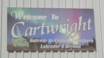
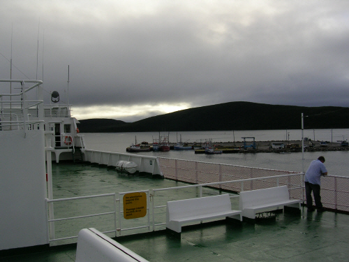
Passing a rainy Saturday in Cartwright, I discovered a piece of historical trivia of interest to my family. The picture below is from the ferry leaving Cartwright. In the background is FlagStaff Hill, which commands a good view of the naturally protected harbor. On top of the hill is a small observation house, more easily seen on zoom. Nearby are two canons installed by the town's founder, Captain George Cartwright, to defend against any privateers attracted by the fish and fur-trading business that he established there near the end of the 18th century.
American and Canadian perspectives on the War of 1812 differ sharply, but that American privateers gave the British the most trouble is historical fact. Among the most successful of these barely legalized pirates were my Rhode Island ancestors. So far as I know, no record exists of them straying this far north, but the canons reminded me to stay on good behavior while in Labrador.
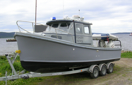
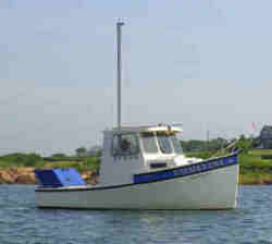
Another discovery in Cartwright brought back memories of earlier trips to the Maritimes, not by motorcycle but by boat or boat and trailer. Moving from sail to power, my last boat, a Rosborough RF-18 built in Halifax, Nova Scotia, exhibited classic Novi design. Very seaworthy, several were bought by the Canadian Coast Guard. A couple of years ago I gave mine (below right), which I believe was the last one made before Rosborough Boats finally discontinued the series, to my nephew. In Cartwright, the Fishery Patrol had opted for the next larger version, shown below left.
After a long night trying to sleep on the floor of the lounge, the ferry arrived in Happy Valley-Goose Bay almost two hours late and in less than ideal weather for motorcycling.
Wet and slippery conditions, not to mention loss of sleep, terminated my planned Sunday ride to Wabush/Lab City at Churchill Falls, but not before I had stopped to chat with the two guys from Ottawa and Montreal. They were on their way to catch the evening sailing of the ferry that I had just departed. Like me, they had had no luck in reserving a cabin or a berth. They also reported that I might bump into BB, whom they had met in Lab City.
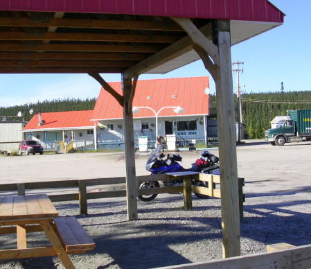
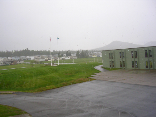
Nor was the weather conducive to taking pictures. The lower or right photograph above was taken from inside a hallway in the Churchill Falls Inn, which occupies part of the town complex -- a single building containing the local school, library, gym, swimming pool, and a large grocery store.
Marathon Day: Churchill Falls to Baie Comeau. The sun came out on Monday, allowing a planned ride to Wabush/Lab City to run all the way to Baie Comeau when accommodations proved difficult to find in the mining towns.
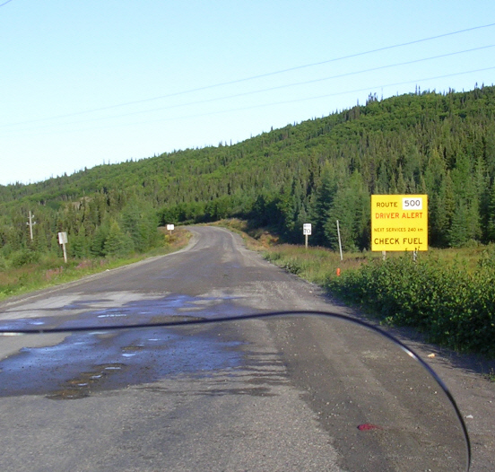
First task, around 8:00 am local time, 7:00 my time (EDT), was to take a picture of the sign at the Churchill Falls Generating Station, which I had gone by the day before. It is the largest underground hydroelectric generating station in the world. Tours are available, but in light of the good weather, I opted for the road, which as the second photograph below shows, was already beginning to dry out.
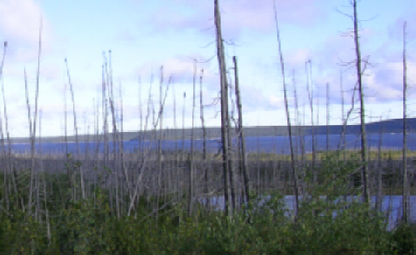
The Smallwood Reservoir, shown below, powers Churchill Falls. It is named in honor of Joseph R. Smallwood, the first Premier of Newfoundland following Confederation in 1949. "Joey" Smallwood, self-described as "the last Father of Confederation," remains a controversial figure in Newfoundland even today, not just for bringing the province into Canada but also for many of his actions during 23 years as premier.
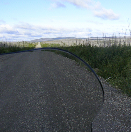
From Smallwood to Wabush/Lab City, much of the Trans-Lab is fairly straight but quite hilly in spots. Contrary to some reports, truckers on the Trans-Lab were uniformly considerate, always pulling well to the right and sometimes even slowing a little. My practice on meeting any vehicle was always to slow and move right. Even at moderate speeds, big trucks on gravel throw stones. And after the road dried, the dust left in their wake resembled driving into fog.

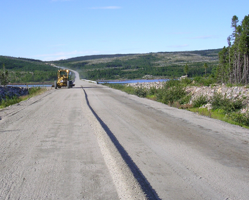
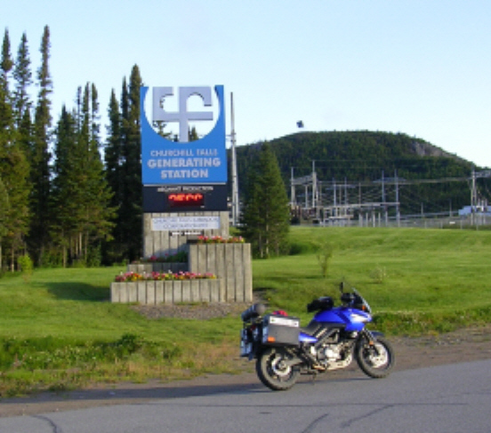
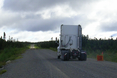
While I was stopped to take a picture of a passing tractor (without trailer) approaching the grader working in the dust cloud in the distance, BB arrived. We compared bikes, discussed road conditions, and took pictures of each other using both our own and the other's camera. BB took the photo at the top of this account on my camera. Note the orange sign warning of the grader that appears in both pictures.
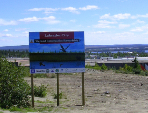
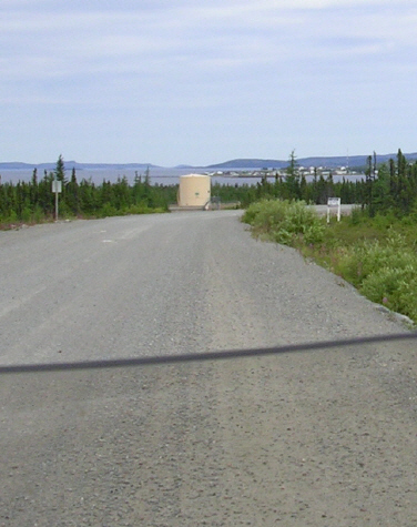
After that pleasant break, next stop was Wabush City, where I was unable to land a room in the Wabush Hotel, reportedly the biggest and best in the area. So on to Lab City, just a few miles away. At the local tourist information office I struck out on rooms but found something more important, a Labrador bumper sticker for my bike. Fortunately I bought three, because the first one dissolved a couple days later in a ferocious thunderstorm north of Burlington, Vermont. The next will go on under a protective clear coating.
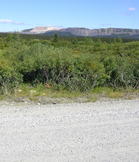
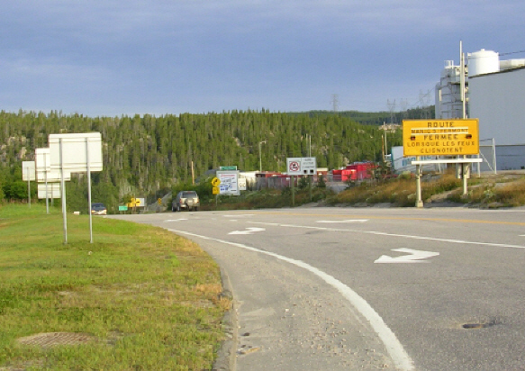
The above sign greets travelers at the top of a hill as they approach Lab City from Quebec. There is a Tim Horton's nearby, and the official Labrador West tourist office is just down the hill. Heading west onto Route 389, the paved surface runs to near Fermont, where it ended at a detour that went straight through the security gate of one of the mining companies. On the other side, the gravel resumed. The picture below shows the open pit iron ore mines, probably those of Quebec Cartier, as viewed from Route 389 west of Fermont. Furthest in the distance is what I believe, possibly wrongly, to be Mount Wright.
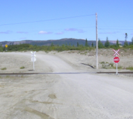
Trains and Twisties on Route 389. Route 389 in Quebec is a narrow winding gravel road with multiple railroad crossings. Many motorcyclists regard it as the most challenging part of the trip, but after the long straights on the Trans-Lab, I found the curves kind of refreshing. Of course, at night or in the rain, they would certainly be more difficult. And even in good weather, caution is necessary.
The curves deprive oncoming trucks of much opportunity to see approaching motorcyclists. What is more, negotiating the curves at speed, the truckers have to struggle to keep their own rigs on the road, frequently using most of it in the process. Gravel tends to accumulate on the outside of the curves, which presents the danger of soft gravel on left handers. Right handers, on the other hand, often present firm and favorably banked ruts that can invite aggressive riding, with the best conditions often found in the middle or center rut. But beware! That is just where an approaching truck is likely to appear.
The railroad crossings themselves seem well-constructed, are well-marked, and in all cases the tracks cross at almost right angles to the direction of road traffic. I counted about ten of these crossings and had to wait for two trains, including one rather long one of empty ore cars. Later I read that there were actually nine crossings.
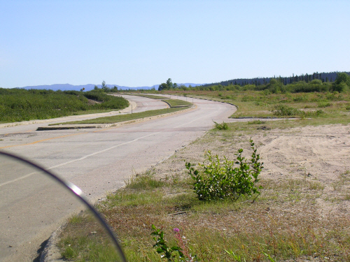
A rather unique curiosity on Route 389 provides some relief from the gravel. Now incorporated into Route 389 is the paved main street (below) of the former town of Gagnon, which was built as a mining town in the 1960's and fully dismantled in 1985 when the mines closed. Actually the pavement starts at the old Fire Lake mine site some 50 miles north of Gagnon, passes a sign indicating the 52nd parallel, and ends just south of the abandoned town.
However, south of Gagnon, the gravel road is wider and straighter. I took an afternoon break at Relais Gabriel (below), where there is a small motel that could provide a port in a storm.
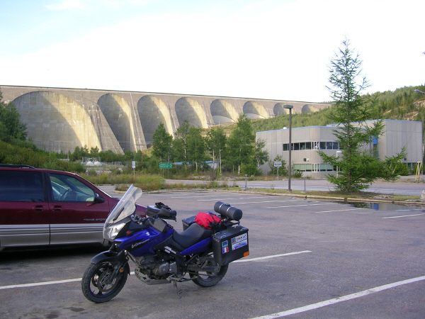
And then on to Manic 5 and its huge dam, le barrage Daniel-Johnson, named in honor of a former premier of the province and the minister responsible for beginning the Manic 5 project. But before finally reaching it, Route 389 faked me out with what proved to be a false end to the gravel road.
As it turned out, there were still a few more gravel twisties to negotiate before reaching Manic 5, where I found Motel de l'Énergie to be virtually full, again with people working in the area rather than tourists.
Although 125 miles and a lot more curves still stood between me and Baie Comeau, the curves were on pavement and an hour of daylight remained. Not enough to make Baie Comeau, but I decided to go for it anyway, breaking my own prohibition on riding at night, especially where animals may be around. And because I don't generally ride at night, neither of my bikes has any special night riding illumination.
Night fell, relieved only a little by a full moon, before I was halfway there. Then my friend in need took the form of a truck indeed. Slowly I caught up to a fast moving big rig driven by a pro who either knew the road well or was crazy. The twisting road presented no opportunities to pass even had I wanted to, but I quickly found that by hanging back a little, I could make pretty good use of the truck's lights, not to mention the smell of its burning brakes whenever the driver entered a curve a bit too fast.
Eventually we came to construction area where the road was reduced to one lane governed by a signal light. Stopped at the light, the trucker waved me forward. I pulled along side, summoning some French in my mind. "Merci, monsieur, mais je préfère vous suivre." The trucker looked perplexed. Was my accent that bad? So I added, "J'aime bien la lumière de tes phares." He laughed, went ahead of me, and proceeded at an even faster pace than before, while I thought to myself what I had not volunteered: "Si on va faucher un orignal, vaut mieux toi que moi." But if he had hit a moose, I would have felt a bit guilty.
Reaching Baie Comeau a little after 9:00 pm, I had covered a little over 500 miles in 14 hours, including all stops, easily the longest, toughest, but also the most interesting 500-mile day I have ever ridden. Completely spent, I opted for the first motel I saw, right on the corner of Route 389 and Route 138, the main highway along the north shore of the St. Lawrence.
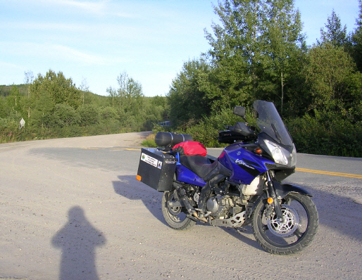
The next morning, before beginning the 450-mile run to Montreal, I took the picture below. This sign, which had marked the end of my Labrador adventure the night before, signals its start for those who make the loop in a clockwise rather than counter-clockwise direction.
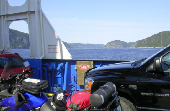
Next Year, Perhaps. Taken from the free ferry that crosses the Saguenay River at Tadoussac, the final picture is a reminder that another but less well-known gravel highway beckons from the area of its headwaters. The Route du Nord (North Road) runs from Route 167 a little north of Chibougamau to Route de la Baie James (James Bay Road) at kilometer 275. Like the Trans-Lab, the North Road can be ridden in either direction but does not have to be ridden in both. Similarly, too, the trip to reach it covers some of the finest motorcycling roads in the world, as anyone who has ridden to Chicoutimi or Lac Saint-Jean can attest.
And if you are a real adventurer, there's another unpaved highway even further north in Quebec: Route transtaiga. Now there's a road where I might really need the extra fuel tank, not to mention that unopened bottle of DEET. Even more problematic, an absence of motels would likely require some camping. Ugh! Mais si tu en as le goût, fais-moi signe.
September 15, 2007